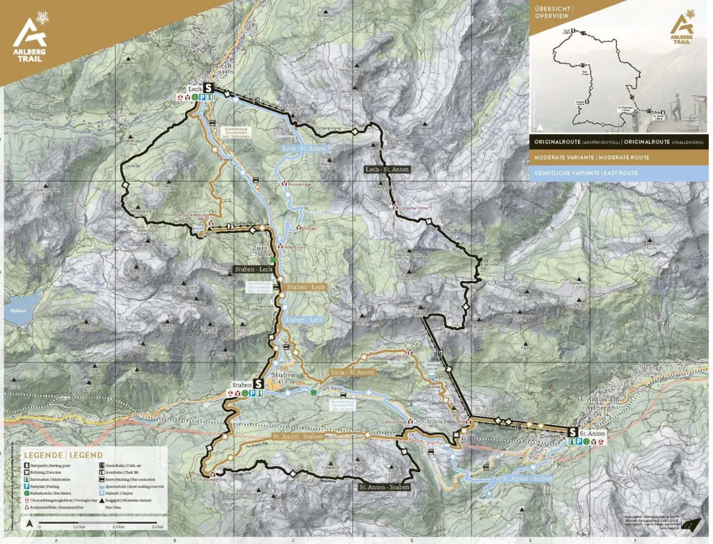
OVERVIEW OF STAGES
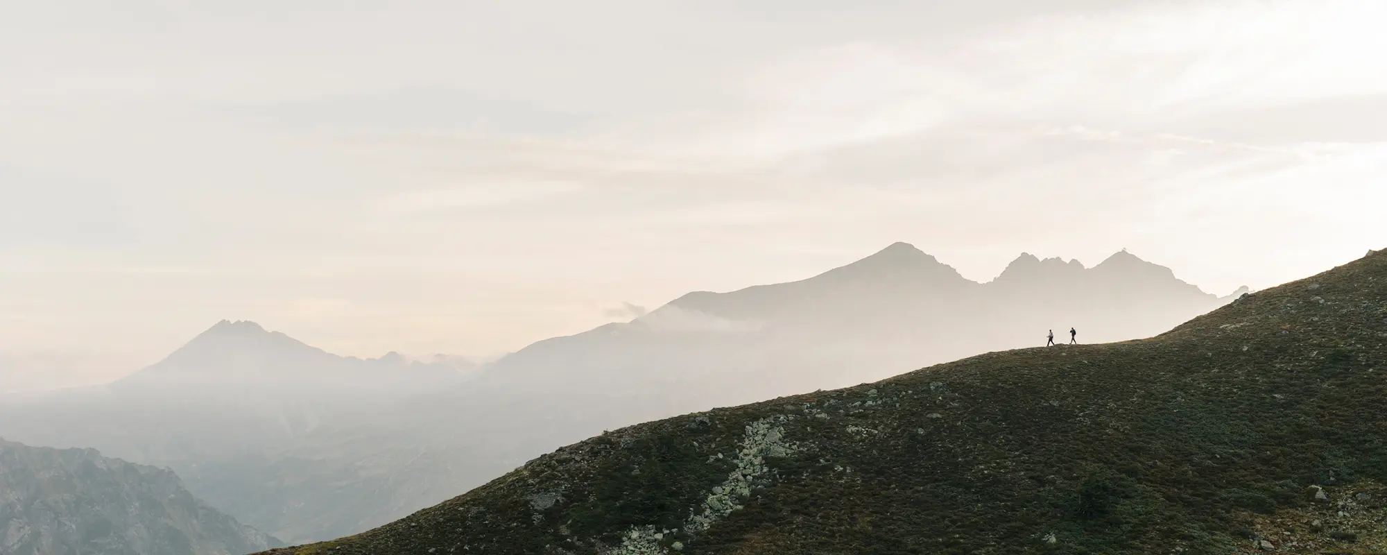
Three stages, three unique experiences, and the choice every day between challenging
Flexible Route Options: Choose Your Trail
The Arlberg Trail combines alpine adventure with maximum flexibility. Each of the three stages can be tailored individually – depending on your fitness level, weather conditions, or preferred hiking experience.
In addition to the challenging original route, two alternative options are available every day: a moderate variant and an easy route. This makes the Arlberg Trail a unique experience for both experienced mountain hikers and leisure-oriented walkers.
Whether you prefer scenic high-alpine trails, relaxed sections, or demanding mountain passages – every day you decide what your trail should look like. Thanks to the integration of cable cars, elevation gain can be reduced without missing out on spectacular alpine scenery.
The result is a long-distance hiking trail that puts freedom at its core: individually customizable, diverse, and perfectly suited to different abilities and expectations.
Tipps for the Arlberg Trail Challenge
- Check for trail closures and current conditions before your hike. Even in summer, you may encounter old snowfields.
- The Arlberg Trail runs through high-alpine terrain. Always check the weather forecast and choose an alternative route in case of unfavorable conditions.
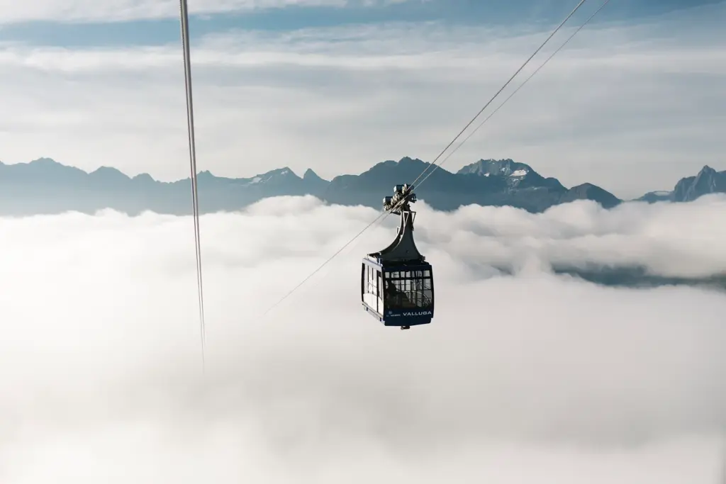
- Pay attention to the operating hours of the cable cars and plan your hike accordingly. It is often recommended to take the first ascent.
- The tour can be started from St. Anton, Stuben or Lech – ideally in a clockwise direction.
Download the PDF version of the Arlberg Trail
Find out more about the Arlberg Trail on Komoot
Discover the Arlberg Trail on Outdooractive
Overview
Stage St. Anton – Stuben
From lush alpine meadows to impressive mountain passes: the first stage of the Arlberg Trail combines the sporting spirit of St. Anton with the tranquil alpine atmosphere of Stuben. Various route options lead through diverse landscapes, passing mountain lakes, moorlands, and spectacular viewpoints.
Stage Stuben – Lech
The second stage leads through the impressive high-alpine landscape surrounding the Flexen Pass. Along panoramic mountain trails, crystal-clear alpine lakes, and scenic ridge paths, hikers experience the diversity of the Arlberg region from a new perspective.
Stage Lech – St. Anton
The final stage offers the most varied experience of the Arlberg Trail. From scenic high-altitude paths and alpine moorlands to spectacular mountain panoramas, this route connects the impressive mountain landscapes of Vorarlberg and Tyrol.
Arlberg Trail Ticket
With the Arlberg Trail Ticket, the cable cars along the route become part of your hiking experience. The ticket is valid throughout the entire summer season and includes one ride on all required cable cars along the Arlberg Trail. This gives you maximum flexibility when planning your individual tour.
The ticket is available at the ticket offices of the Galzigbahn, Rüfikopfbahn, and Seekopfbahn cable cars.
| Adults | € 75,00 |
|---|---|
| Children | € 42,00 |
Please note the operating hours of the cable cars:
| Rüfikopfbahn | 8:30 am – 05:30 pm, 00. 30. |
|---|---|
| Galzigbahn | 8:15 am – 16:30 pm |
| Vallugabahn I | 8:30 am – 16:10 pm |
| Seekopfbahn | 9:00 am – 17:00 pm |